About Course
Professional Timber Harvester Program Continuing Education Online Module
Instructions:
- Read through and study the module sequence. At the end of the module, click on the link to take the quiz. You may leave the module open during your quiz to assist.
- When you’ve completed the quiz, MPFA will receive a notification, score the quiz and send your continuing education certificate.
Course Content
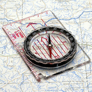
Map Reading and Compass Use For Loggers, Landowners, and Foresters
-
Why do we need to use a map and compass?
-
Topographical Map
-
Contour Lines
-
Contours
-
Contour Characteristics
-
A Typical Topo Map
-
3-D Topo Map
-
Map Scale
-
Brain Teaser
-
Topo Map Symbols
-
Compass Use
-
Declination
-
Declination (continued)
-
Relationship Between True Bearings and Azimuths
-
Always Orient Your Map!
-
Township Range and Sections
-
Townships and Ranges
-
Legal Description within a Section
-
Examples
-
Quiz Instructions:
Student Ratings & Reviews
Interesting
The course was informational and advantageous.